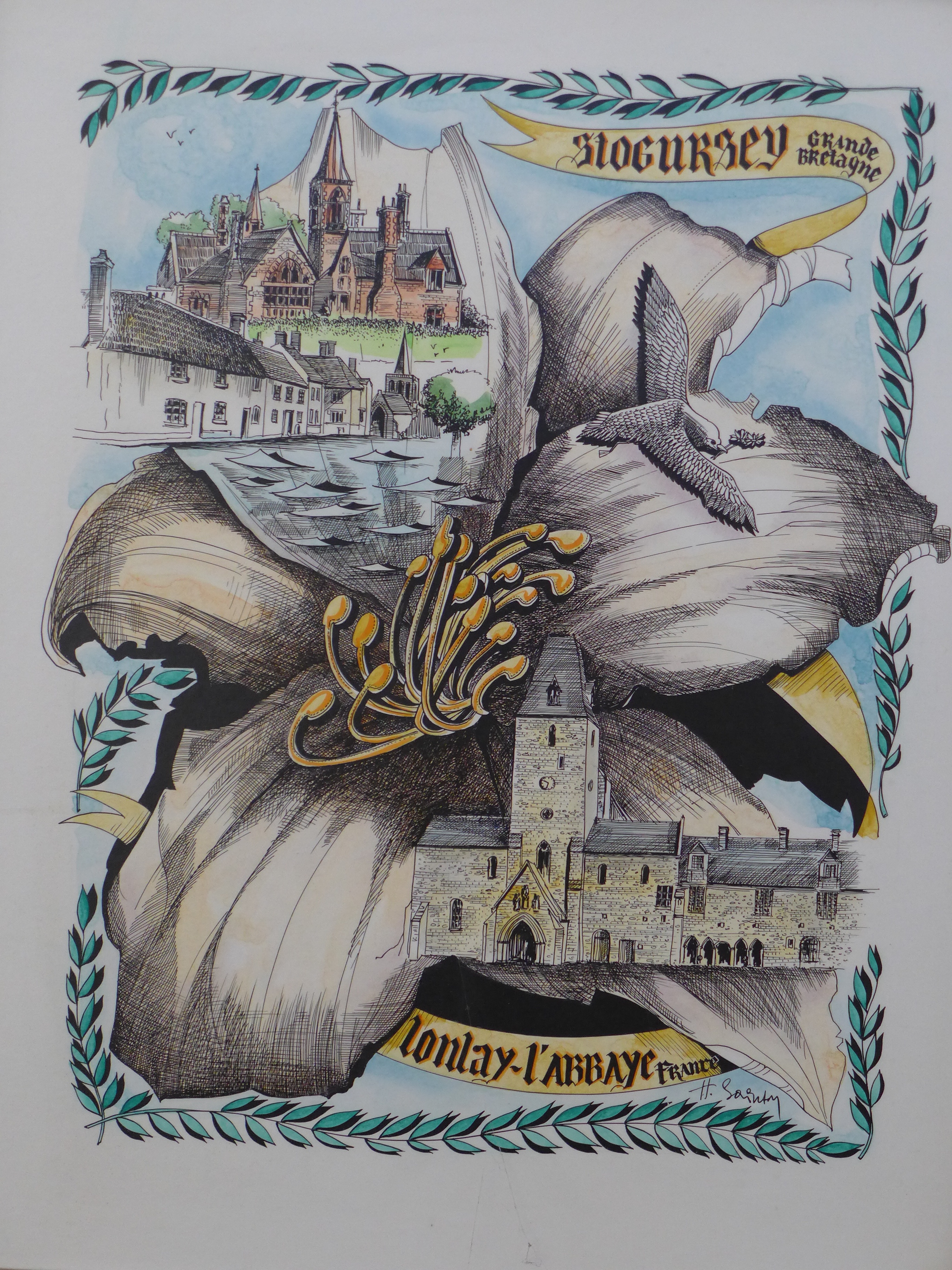
The Power of Place: In and Around Stogursey where past and present meet…
“Like those of other living things, our structure, development, and behavior rise from a genetic foundation sunk in an environmental context.” p.16 ‘The Power of Place’ by Winifred Gallagher 1993 (note before the advent of consumer DNA testing)
It has been some time since I promised to expand upon my trip to England in April of this year. I have wanted to get to it, but something held me back each time, as if I could not see it clearly just yet. With the recent discovery of a connection between our WHEATON Group B and VERBEECK (BEKE) and a Norman/Flemish/Celtic common ancestry there is more focus which makes stitching the bits and pieces together a little clearer.
On my list of places to visit in Devon and Somerset the last one: Stogursey. It was prompted by a single record:
5 Jul 1599 in the parish of St. Andrews, Stogursey: Robert Wheaddon married to Joan HUISH also spelled Johanne Huyshe.
Perhaps the Robert we are looking for is a child of this Robert? The baptism’s for St. Andrews begin in 1609—too late to have recorded the baptism of our Robert. Across the channel in Flemingston, Wales are 2 baptisms to a Christopher Wheaton in 1601 and 1602. Flemingston was named for John Fleming, one of the twelve knights who came with Robert Fitz Hamon, in the time of William Rufus son of William the Conqueror. While visiting the church in nearby St Deucmans there are windows dedicated to Welsh saints Decumans, Petroc and Carnatoc.—we like to think of these places as separate but they were not. Like the channel between France and England that between England and Wales was negotiated for thousands of years.
Den and Jean Wheaton chauffeured me all over Devon and Somerset exploring possible connections to the various WHEATON groups but one of my main missions was to look for a place that “felt” connected to Robert WHEATON of Rehoboth, Massachusetts. It is admittedly a rather odd way to conduct genealogical research, but lacking a specific homeland it seemed as good a way as any. My trip’s purpose was to get the lay of the land, meet my long time friend and fellow WHEATON researcher, Jean, her husband Dennis and hope that a place called to me.
We had driven the whole length of Devon from North to South and back North again through Somerset and I loved it, all the while I kept thinking could this be the place? Or this? The beautiful coasts, verdant valleys and windswept moors were very much to my liking. As we drove from St. Deucmans near Watchet to Stogursey I found myself saying, “yes, this feels like it.” Please note the original name was Stoke Curci or Coursey.
The lowlands between St. Deucmans and Stogursey resemble the area around Rehoboth, Massachusetts. The swamp lands, the forests, the grazing areas and most of all the water! Both Stogursey and Rehoboth are just inland from a major channel that leads out to the Atlantic Ocean. And they both lie elevated but not too much above sea level. This area also has the requisite forests yielding bark, rivers with ample water and the grazing land that would produce the livestock from which the hides that would be needed for a tanner like Robert WHEATON.
Stogursey: Elevation 111′ annual Rainfall 36″, distance to Bristol Channel 2 miles
Rehoboth (original Rehoboth, now Runford, RI): Elevation 62′, Annual rainfall 46″, distance to Providence River 1 mile
Since my return and with my curiosity piqued I have plenty of circumstantial evidence that suggests an origin in this area would make sense. Although it may not be this specific place beginning here seems as good a place as any. Below is one of my photo of the remains of Stogursey Castle with the spire of St. Andrew’s Church of Stogursey in the distance.

Stogursey Castle
The National Trust now holds the property and describes:
“Stogursey Castle’s origins lie with William the Conqueror’s need to consolidate his new kingdom. He granted the manor of Stoke to William de Falaise who built a castle on the site as one of a chain running from Dunster to Montacute, to protect Somerset from invasion from the sea. It seems de Falaise did not build the typical motte (defensive mound) since the remains of a later, stone building have been found beneath the existing mound. Instead, his defences took the form of the ‘castle ringwork’, a hall or keep with a timber stockade, on a flat area defended by a strong bank and a ditch.”
I find this remark a bit curious as in the surrounding area the most important landmarks date back thousands of years, suggesting to me that perhaps the site of this castle was an earlier Celtic hill fort or settlement. If I were to venture a guess, Bell Beaker Celts may have inhabited this place, later to be supplanted by invading Roman armies and then rebuilt yet again by the Norman conquerors. The bridge dates to the 13th century and was uncovered during renovation. The gatehouse retains 16th century roof timbers. The history of this area like all of the isles is like peeling back an onion, with layers and layers of habitation lying hidden beneath our feet.
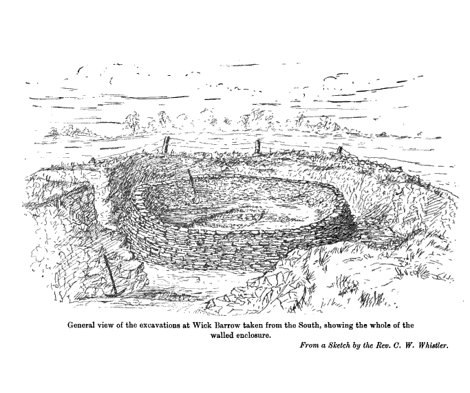
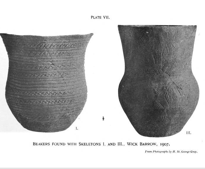
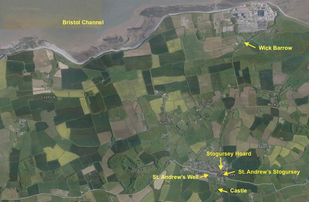
Let’s take for example the nearby “Wick Barrow” also called the “Pixie’s Mound” which is about 1.75 miles due north of Stogursey adjacent the Bristol Channel:
“Wick Barrow is a rare example of a Neolithic round barrow, dating from about 6,000 years ago. It measures about 25 metres in diameter and 1.5 metres high. A barrow is a name given to a structure for buying the dead….It is roughly 7.5 miles from Bridgwater in the parish of Stogursey, Somerset. It was excavated by Harold St George Gray in 1907….The majority of the burials found by Gray lay above, but mostly within the area of the walled enclosure. The main burials included three crouched skeletons dating to the late Neolithic, about 4,400 years ago. Skeleton 1 was accompanied by a bell shaped beaker. Skeletons 2 and 3 were accompanied by long-necked beakers and flint tools.” https://archaeologyathinkleypoint.wordpress.com/wick-barrow/
This video about the mound is entered into a 2015 competition next month in Italy. https://m.youtube.com/watch?v=Bqd7RJO57yM
Let me remind you about the Bell Beakers from the map I posted earlier:
 From Wiki:
The Bell Beaker culture is understood not only as a particular pottery type, but as a complete and complex cultural phenomenon involving metalwork in copper, gold and later bronze, archery, specific types of ornamentation and shared ideological, cultural and religious ideas. The Bell Beaker period marks a period of unprecedented cultural contact in Atlantic and Western Europe on a scale not seen previously, nor again seen in succeeding periods… from c. 2400 BCE (Before Current Age= BC) Bell Beaker expanded eastwards over parts of Central and Eastern Europe. Beaker-type vessels remained in use longest in the British Isles; late beakers in other areas are classified as early Bronze Age…The new international trade routes opened by the Beaker people became firmly established and the culture was succeeded by a number of Bronze Age cultures…
The importance of these localized finds must be viewed within the larger context of recent discoveries and the serendipity that life engenders. As any of you who have followed me awhile— everything leads to something else—and that is sometimes why I have a hard time bringing it all together. I posted this on my FACEBOOK page on September 9th:
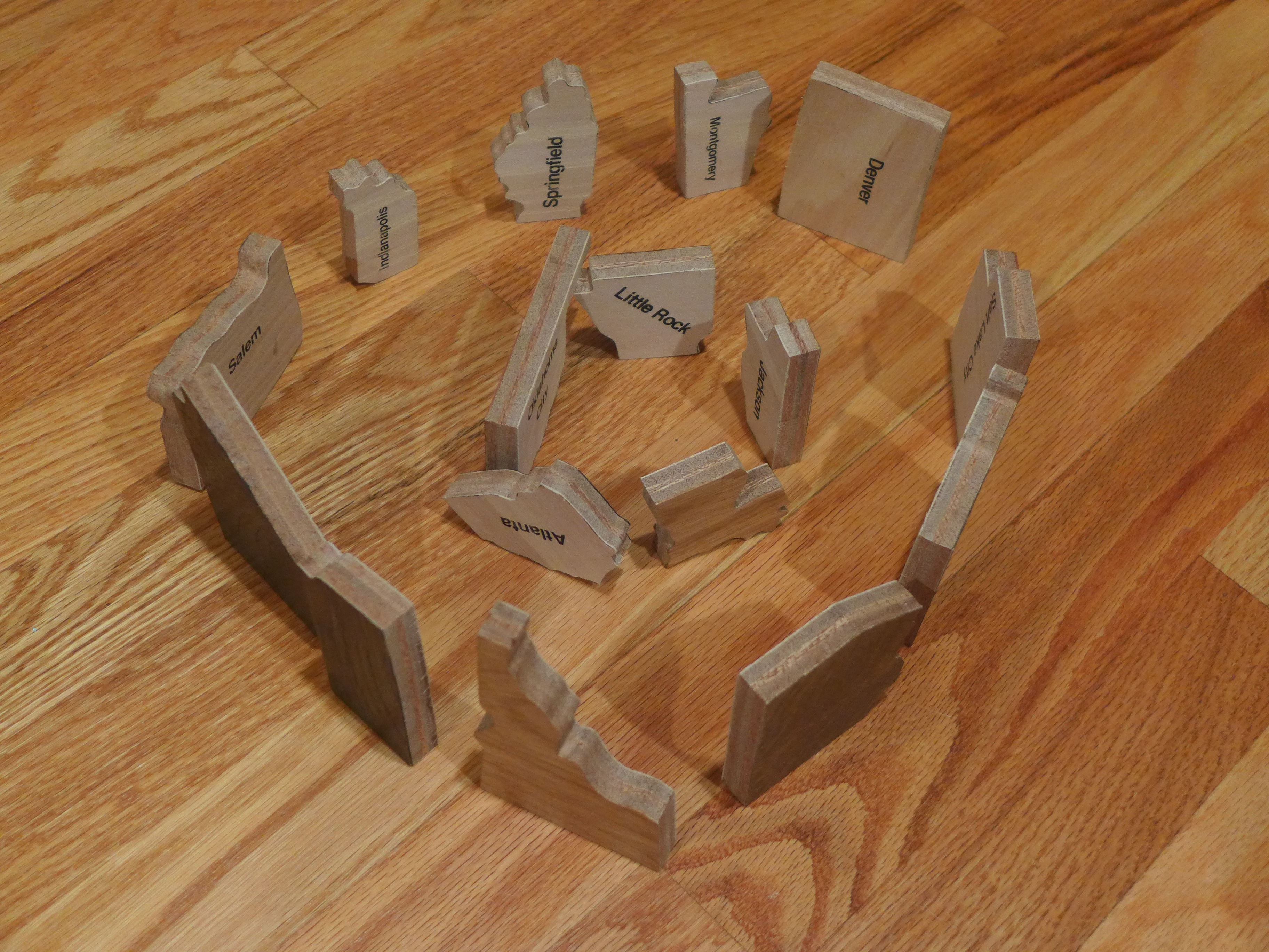
My 5 yr old Grand-daughter’s creation with US states puzzle pieces. I said, “That looks like Stonehenge.” She said, “What’s Stonehenge?” So I pulled out some books and showed her some photos but they did not show the scale so we went online and found some with people in it. She said, “Those are huge.” Then we talked about where the stones had come from and how long ago it was built….Then later on the news, she says “Nona, look Stonehenge.” It was the discovery of the new buried stones north of Stonehenge. She was so excited and so was I.
So whether we are talking the ancient Neolithic and Bronze age Bell Beakers, the Romans, Normans or more recent travelers, our lives and those of our ancestors are ones of a huge network of relationships. The areas of science that deal with these things whether, linguistics, archaeology, anthropology or genetics often have a difficult time integrating the various elements and even a harder time of making the connection to us. But let us try—
Back in Stogursey, when looking for more information before my trip I came across this: A large hoard of late 3rd century Roman coins found in 1999 in Stogursey including 1,097 basal silver radiates, 50 copper allow coins and pottery vessel remains dating from 276 CE (AD). There was also a Bronze Age gold ornament found at the same time, but it is not considered to be part of this hoard. Near Stolford just to the right (East) of this photo on the beach are the remains of a submerged forest dated to 2500 BCE.
As soon as I started looking for connections they began to surface everywhere. After my return I was notified of DNA from a study conducted in the Bristol area which found three men bearing the same FGC22501 mutation that our WHEATON Y chromosome uncovered. The estimated age of the L2 mutation (parent of FGC22501) is about 4200 hundred years ago, so FGC22501 must have happened more recently. You might remember this map of the Bristol study area. It ends along the River Parrett about 5 miles away from Stogursey.

So what makes that important? Well we have at least 3 males that carry the same ancient Y-DNA mutation FGC22501 within a short distance of Stogursey. We have a Robert Wheddon marrying in the right time frame and since to date the only other men in England to carry these mutations are a TRIPP from Lincolnshire, a KIDD of unknown origins in England and a WHIFFING from Surrey these are the closest data points to the target area. Then this past month we got our most exciting DNA match with a VERBEECK form Belgium who is a wealth of information on Norman-Flemish and Celtic families and movements.And VERBEECK and TRIPP share another 7 downstream mutations bringing the time frame to a MRCA (Most Recent Common Ancestor) probably about 700-1000 years ago. In other words about the time of the Norman conquest.
So we combine DNA datasets with historical facts, and migrations and we start to build some likely scenarios that connect the dots. And one of the dots is a relationship between the Church of St. Andrew’s and its association with l’abbeye de Lonlay in Normandy, France its mother foundation. Below is the photo I took from within St. Andrew’s church. So one of the ways that DNA may have come to this area is via Norman invaders and settlers. William de Falaise or a member of his entourage or one of the many other Norman Counts may be the connection. A rough guestimate might place the FGC22501 SNP at about 1500 BCE so certainly a possible Bronze age time frame making those Bell Beakers a very real possibility. Where it occurred is not known, but most likely in one of the pockets of Bell Beakers shown on the above map. Although our thoughts are pulled towards the idea that this SNP occurred on mainland Europe we must always keep in mind the possibility that it occurred in the British Isles and moved in a counter-intuitive direction–even as this is less likely.
It is certainly a very real possibility that it came with the Normans. To this day the parish maintains ties with the mother house in Lonlay. Falasie is about 30 miles form Lonlay. William de Falaise had holdings in Devon, Dorset, Somerset and Wiltshire. The Domesday book records 17 holdings in Devon a mere 3 in Somerset but include Stogursey, Woodspring and Wooton Courtney. Woodspring was given to him by Serlo de Burcy whose daughter William married. In comparison large land owners like William de Mohun who held Dunster, Watchet, and Cutcombe (Wheddon Cross) and a much higher number of properties across the same four counties. The point being the connections between the Norman-Flemish and the north Somerset area of England and the DNA of 6 men from England and their counterparts in Belgium and Romania. Lest we be too hasty in our conclusions it is possible that some of the FGC225001 matches migrated earlier with the Flemish-Roman soldiers or even earlier with the Bell Beakers…too soon to tell. What I can say is that there has been a long-standing interchange of genes and trade between Northern France, Flanders and the Bristol channel area.
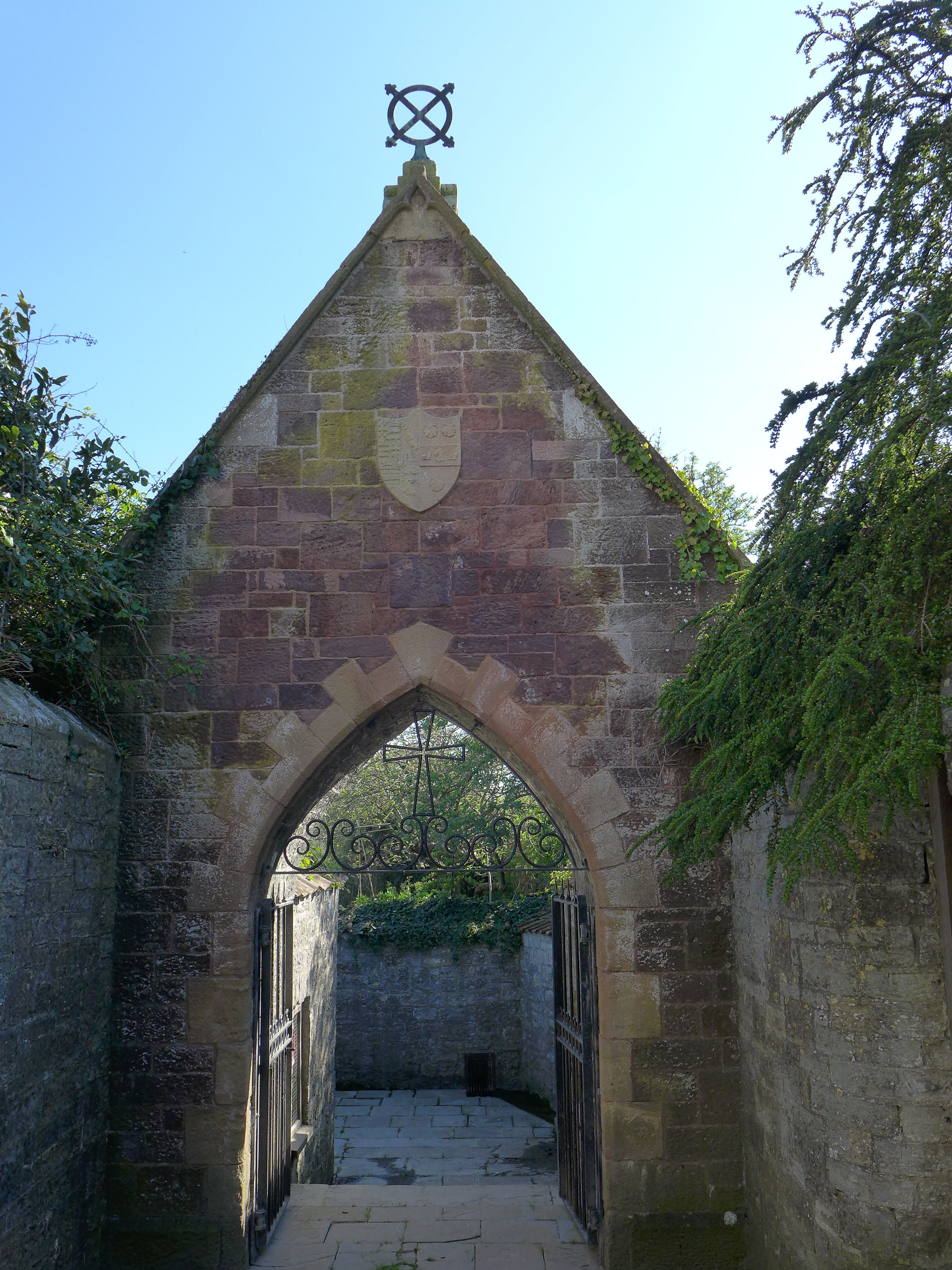
Entrance to St. Andrew’s Well
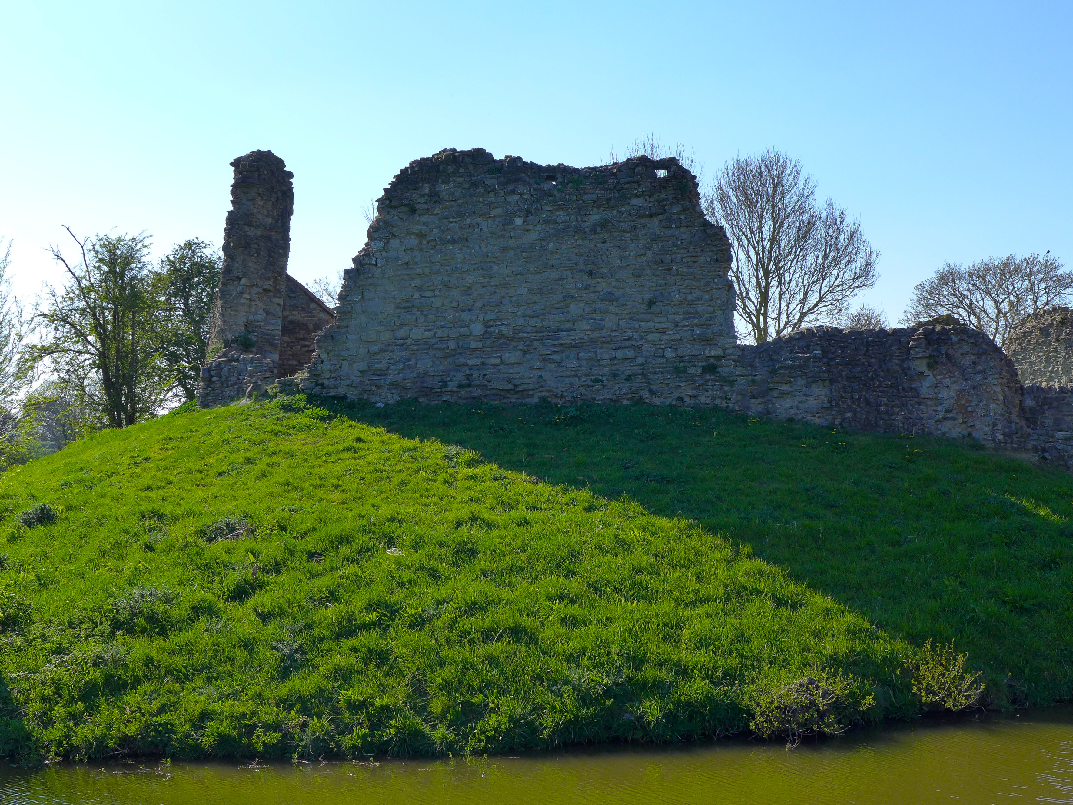
Stogursey Castle Walls
For now let me leave you with this lovely description from the “Land of the Quantock: A Descriptive and Historical Account” By Rev. William H.P. Greswell. 1903 p139:
“The scene is peaceful enough all around the castle…Castle, church, priory, mill, and pound [pond], all side by side, show in their complete form the outlines of the Norman village. Down the valley is the sea that roars on “Shurton Bars,” not far off the thriving port in old days of Stoverd of Stolford. The deep and well-worn lane leasing straight from the old gateway, seems to point seawards and to the Parret [River,] as if this castle meant to guard the access to the sea. It is the sea that has imparted the breath of adventure to this Norman fortress. Down by the landing-place the chapel of St. Michael’s stood, long since a ruin. [at Stolford].”
